


PRESTON - T 2 Voting District, Adams County, Wisconsin
About
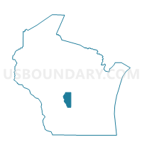
Outline

Summary
| Unique Area Identifier | 692171 |
| Name | PRESTON - T 2 Voting District |
| County | Adams County |
| State | Wisconsin |
| Area (square miles) | 7.20 |
| Land Area (square miles) | 6.85 |
| Water Area (square miles) | 0.36 |
| % of Land Area | 95.02 |
| % of Water Area | 4.98 |
| Latitude of the Internal Point | 44.04632500 |
| Longtitude of the Internal Point | -89.82011150 |
Maps


Graphs
Select a template below for downloading or customizing gragh for PRESTON - T 2 Voting District, Adams County, Wisconsin


Neighbors
Neighoring Voting District (by Name) Neighboring Voting District on the Map
- BIG FLATS - T 1 Voting District, Adams County, WI
- PRESTON - T 1 Voting District, Adams County, WI
- PRESTON - T 3 Voting District, Adams County, WI
- STRONGS PRAIRIE - T 1 Voting District, Adams County, WI
Top 10 Neighboring County Subdivision (by Population) Neighboring County Subdivision on the Map
- Preston town, Adams County, WI (1,393)
- Strongs Prairie town, Adams County, WI (1,150)
- Big Flats town, Adams County, WI (1,018)